If you like walking, the mountains behind the coast are the best surprise of a stay at El Paraíso. Within about an hour you can climb La Concha above Marbella, walk under the rare Spanish firs of the Sierra de las Nieves National Park, swim in the river pools of Istán or follow an old water channel along the Guadalmina. We run El Paraíso, a self-catering apartment in Benahavís between Marbella and Estepona, and this is the hiking guide we give our guests.
Distances, times and rules below come from official route sheets and town hall pages, checked in October 2026. Drive times are rough figures from the apartment.
Hiking near Benahavís at a glance
| Walk | Distance | Official time | Level | Drive from El Paraíso |
|---|---|---|---|---|
| Sendero de las Acequias, Benahavís | 4.3 km loop | not stated | easy | about 10 to 15 min |
| Castillo de Montemayor, Benahavís | 6.5 km there and back | about 1 hour 30 min each way | low to moderate | about 15 min |
| Juanar to the Macho Montés viewpoint, Ojén | 2.9 km each way | 1 hour 15 min each way | easy | about 40 to 45 min |
| Juanar to La Concha (PR-A 168) | 5.5 km each way | 3 hours each way | moderate, one tricky pass | about 40 to 45 min |
| Istán to La Concha (PR-A 135) | 5.5 km each way | 3 hours each way | hard, faint path | about 30 min |
| Istán to the Charco del Canalón (PR-A 280) | 7.2 km each way | 1 hour 30 min each way | medium, river crossing | about 30 min |
| Paseo de los Pinsapos, Sierra Bermeja | 1.5 km there and back | about 1 hour | easy, uneven path | about 45 min |
| Los Quejigales to the Torrecilla (SL-A 140) | 7.2 km each way | 3 hours 15 min each way | hard | about 1 hour 30 min |
"Each way" means the official time covers the walk out only, so double it for the return.
Start in Benahavís: easy walks along the Guadalmina river
Benahavís village is about 10 to 15 minutes from the apartment, and its tourism office lists several signed routes that start in or near the village.
Sendero de las Acequias del Río Guadalmina
The gentlest walk in this guide: an easy 4.3 km loop for the whole family. More than ten centuries ago the Arabs channelled part of the Guadalmina river to water their orchards, and the old channel is now a footpath with a wooden bridge over the Cañón de las Angosturas and picnic tables along the way. Park at the Explanada de la Ermita, about 2 km from the village; the path starts about 400 metres further on, just before the bridge.
The Sendero de las Libélulas is another easy loop, about 3.5 km from the village centre along the river to the Azud del Guadalmina weir and back by the Camino del Molino.
Castillo de Montemayor
For views, walk up to the ruins of the Castillo de Montemayor on the Montemayor peak at 579 metres. The signed route (PR-A 165) starts in Benahavís and is about 6.5 km there and back. The Western Costa del Sol hiking guide gives about 1 hour 30 minutes each way and a climb of a little over 400 metres, mostly on a comfortable track with a steep path at the end. On clear days you see up to 100 km of coast and the coast of Africa.
The wet walk through the gorge, wading and swimming between pools, has its own guide: the Benahavís River Walk. For coffee and lunch, see the Benahavís village guide and our restaurants in Benahavís.
La Concha mountain: the classic climb above Marbella
La Concha is the shell shaped peak you see behind Marbella from almost everywhere on this coast. At 1,215 metres it is the second highest summit of the Sierra Blanca, and from the top you look down on the whole coast and the Concepción reservoir. There are two signed ways up, one from Juanar above Ojén and one from Istán. Both meet on the last part of the ridge, about 15 minutes below the summit.
From Juanar (PR-A 168)
This is the classic route and the one most people take. The official sheet gives 5.5 km one way, about 3 hours, 577 metres of climbing and 308 metres of descent along the way, and recommends any season except summer. You start at the Hotel Refugio de Juanar, or at the gate a little higher, follow the track to the Cortijo de Juanar and climb through pine woods to the Puerto de las Allanás, where a short detour leads to the Cruz de Juanar at 1,184 metres.
The second half follows the ridge west, about 1,000 metres above the sea. The path is rocky and sometimes hard to follow, and Marbella tourism calls the Salto del Lobo the most difficult pass: take it slowly on the right hand side. You pass the Cerro Lastonar, at 1,279 metres the highest point of the Sierra Blanca, and the last airy stretch to La Concha is the most beautiful. Plan a full day.
From Istán (PR-A 135)
The route from Istán is also 5.5 km and 3 hours one way, but the Sierra de las Nieves route sheet rates it hard. The path is very faint in places, there is little shade, and near the top there is no clear path at all, only cairns, until you join the Juanar route at the Cepilla del Enebro. It starts just above the Hotel Altos de Istán, and the village has a public car park at the Plaza del Calvario. Choose it only if you are used to finding your way on rough ground.
Juanar and Ojén: the easy way into the Sierra Blanca
Ojén, Spain, is a small village just off the A-355 behind Marbella, and the Juanar road above it is the gateway to the Sierra Blanca. From the apartment it is about 40 to 45 minutes to the Refugio de Juanar: take the A-7 towards Marbella, the A-355 past Ojén, and turn off at kilometre 23.8 for the Refugio. The whole municipality lies in the protection zone around the national park.
If La Concha is too much, walk the Junta de Andalucía path from Juanar to the Puerto de Marbella. It is 2.9 km one way, about 1 hour 15 minutes, and rated easy for all ages. Take the forest track on the left about 100 metres from the Refugio and leave the car at the gate. The path passes the Juanar olive grove and viewpoints over Ojén and the Marbella coast, and ends at the Mirador del Macho Montés with its ibex statue. Real ibex are common here too.
Istán: river pools and the Río Verde
Istán is a quiet white village above the Río Verde reservoir, about 30 minutes from El Paraíso on the A-7176 from the coast near Marbella. Almost two thirds of its municipality lies inside the Sierra de las Nieves National Park, and the town hall publishes ten signed short routes plus two paths to the river pools, with maps and GPS tracks on its website.
Our pick is the PR-A 280 to the Charco del Canalón, which the town hall calls one of the most spectacular corners of the Río Verde valley. It is 7.2 km one way, about 1 hour 30 minutes, medium difficulty, with a maximum climb of 334 metres, starting at the Plaza del Cha. It passes orange and avocado orchards and a viewpoint over the river before dropping to the water. Bring a swimsuit in the warm months and take care crossing if the river is high.
For a shorter swim, the SL-A 241 follows a concrete track to the shallow Charco La Huerta, good for small children, and the SL-A 224 leads to the Charco El Cancho, the deepest pool on the Río Verde at up to 4 metres in summer. Water levels change with the season, so look before you jump.
Sierra de las Nieves National Park: pinsapos and the Torrecilla
The Sierra de las Nieves became Spain's sixteenth national park in July 2021. It covers almost 23,000 hectares of Málaga province, including parts of Benahavís, Istán, Ronda, Tolox and Yunquera. The Junta de Andalucía highlights its limestone landscapes and its forests of pinsapo, the Spanish fir, which grows wild only in a handful of Andalusian mountains, with close relatives in northern Morocco.
Los Quejigales to the Torrecilla (SL-A 140)
The big day out is the climb to the Torrecilla, the highest peak of the park at just over 1,900 metres. The official route starts at the Los Quejigales picnic area and is 7.2 km one way, with an estimated 3 hours 15 minutes for the way up and a high difficulty rating on stony paths. You climb through the old pinsapo forest of the Cañada del Cuerno, pass restored snow wells, where snow was once stored as ice and carried down to Málaga, and stop at the spring of the Pilar de Tolox before the last 100 metres of steep climbing. On clear days you can see Sierra Bermeja, Africa and the Sierra Nevada. It can be very hard in summer heat and in winter ice.
To get there, drive the A-397 from San Pedro towards Ronda, the same mountain road as in our Ronda day trip guide. About 15 km before Ronda, turn right onto a track that is paved at first; after about 8 km keep left at the fork and Los Quejigales is about 800 metres further. It is about 50 km and the track is slow, so allow around 1 hour 30 minutes. Cars are banned on the track from 1 June to mid October because of fire risk (walkers may still go in on foot), and in October 2026 the park advised checking official notices before driving up.
Sierra Bermeja: the pinsapo forest above Estepona
Sierra Bermeja is the mountain behind Estepona, named for its reddish colour. Its Paseo de los Pinsapos is the easiest way to see the Spanish fir from El Paraíso. Estepona's tourism office describes a 750 metre path through the only pinsapo forest in the world growing on peridotite, about 1.5 km there and back and about 1 hour. The ground is uneven, and the path ends at a little square with a poem by Federico García Lorca on a mural.
From Estepona, take the MA-8301 up into the mountains for about 14 km to the Puerto de Peñas Blancas, then the road on the left towards the Pico de los Reales. The start is on a sharp hairpin bend a few kilometres up, marked with a wooden sign. Allow about 45 minutes from the apartment. Fitter walkers can make a 6.5 km loop up to Los Reales, at 1,452 metres the highest point of Sierra Bermeja, with about 360 metres of climbing and around 2 hours 30 minutes, according to Estepona's nature site. Avoid these paths in fog or rain. A large forest fire in September 2021 damaged hundreds of pinsapos around the walk, and replanting is under way. Our Estepona guide has ideas for lunch on the way back.
When to go and what to bring
Autumn, winter and spring are the hiking seasons. The La Concha route sheets advise any time except summer, when the high paths are hot and shadeless, so in July and August keep to the river walks and start early. Our Costa del Sol weather by month and October and November guides help you pick a good week.
- Shoes: walking shoes with grip for stony and wet paths.
- Water and sun: plenty of water, sun cream and a hat.
- Phone: the emergency number is 112, but the Junta reminds walkers that there is not always phone coverage. Tell someone where you are going.
- Fire: lighting fires is not allowed on these paths. From 1 June to 15 October Andalucía is in its high fire risk period, when barbecues and burning are banned across the region.
- Nature: stay on the signed paths, do not pick plants and take your rubbish home.
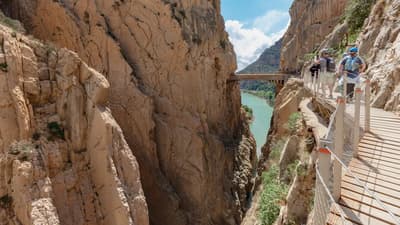
You need a car for most of these walks; see our car rental guide. For more days in the hills, the white villages near Benahavís and the Caminito del Rey both make great full days.
Hiking near Benahavís FAQ
Where is the Sierra de las Nieves?
Inland from Marbella and San Pedro, between the coast and Ronda. Benahavís and Istán both have land inside the park, and Istán is about 30 minutes from El Paraíso.
How long does the La Concha Marbella hike take?
About 3 hours one way from Juanar or Istán, both about 5.5 km, so plan 6 hours or more for the round trip.
Is La Concha dangerous?
It is a real mountain walk. From Juanar it is rated moderate with one tricky pass and an airy final ridge; from Istán it is rated hard because the path is faint. Go in good weather with proper shoes and plenty of water.
Do I need a permit to hike in the Sierra de las Nieves?
The official route sheets we used for these signed paths mention no permit or booking for walkers. Car access is what changes: the Los Quejigales track closes to cars in the summer fire season.
What is the easiest walk near Benahavís?
The Sendero de las Acequias along the Guadalmina, a 4.3 km family loop, or the 2.9 km path from Juanar to the Macho Montés viewpoint.
Stay close to the mountains
El Paraíso is a calm base for walking days: Benahavís and the Guadalmina are on the doorstep, Istán and Juanar are under an hour away, and golf views and outdoor dining wait after a long day on La Concha. Check dates on our homepage or on the Airbnb listing. For more ideas, see things to do in Marbella from El Paraíso.
Written by Mex Smits
Distances, times and rules come from route sheets and pages of the Junta de Andalucía, the Sierra de las Nieves National Park, MITECO and the Benahavís, Istán, Marbella and Estepona tourism offices, checked in October 2026. Drive times are approximate. Paths, access and rules change, so check the latest notices before you go.
Hero photo: Pico de la Concha in the Sierra Blanca above Marbella, by Tyk, via Wikimedia Commons, licensed CC BY-SA 4.0 (cropped and resized).